![](/images/other/stat-length.png)
![Tocht Te voet Mesão Frio (Santo André) - Rota do Pico da Vila - Photo](https://media.geolcdn.com/t/1900/400/5daa92f5-c7d4-4e0f-9d7a-955b6c173253.jpeg&format=pjpeg&maxdim=2)
Rota do Pico da Vila
SityTrail - itinéraires balisés pédestres
Tous les sentiers balisés d’Europe GUIDE+
![Lengte](/images/other/stat-length.png)
Lengte
3,9 km
![Max. hoogte](https://static1.geolcdn.com/siteimages/upload/files/1508320355ic_sort_altitude_max_24dp.png)
Max. hoogte
303 m
![Positief hoogteverschil](https://static1.geolcdn.com/siteimages/upload/files/1508320355ic_sort_den_pos_24dp.png)
Positief hoogteverschil
98 m
![Km-Effort](/images/other/stat-length.png)
Km-Effort
5,6 km
![Min. hoogte](https://static1.geolcdn.com/siteimages/upload/files/1508320355ic_sort_altitude_min_24dp.png)
Min. hoogte
66 m
![Negatief hoogteverschil](https://static1.geolcdn.com/siteimages/upload/files/1508320355ic_sort_den_neg_24dp.png)
Negatief hoogteverschil
243 m
![Boucle](https://static1.geolcdn.com/siteimages/upload/files/16400158638029165_repeat_loop_refresh_sync_direction_icon.png)
Boucle
Neen
Markering
Datum van aanmaak :
2022-02-14 14:46:47.118
Laatste wijziging :
2022-02-14 14:46:47.118
![Te voet](https://static1.geolcdn.com/sitytour/trail-icons/100.png)
1h16
Moeilijkheid : Gemakkelijk
![Scan deze QR-code om de tocht te openen in de SityTrail-applicatie](https://capi.geolives.com/qq0zvz2zws4bq2lad0pu/sitytour/trails/3109248/qr.png?size=200)
Gratisgps-wandelapplicatie
Over ons
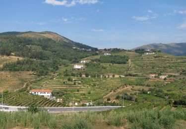
Tocht Te voet van 3,9 km beschikbaar op Norte, Vila Real, Mesão Frio (Santo André). Deze tocht wordt voorgesteld door SityTrail - itinéraires balisés pédestres.
Beschrijving
Trail created by Município de Mesão Frio.
Symbol: Yellow over Red
Plaatsbepaling
Land:
Portugal
Regio :
Norte
Departement/Provincie :
Vila Real
Gemeente :
Mesão Frio (Santo André)
Locatie:
Vila Jusã
Vertrek:(Dec)
Vertrek:(UTM)
592749 ; 4556633 (29T) N.
Opmerkingen
Wandeltochten in de omgeving
![Tocht Te voet Mesão Frio (Santo André) - Rota dos Quatros Caminhos - Photo](https://media.geolcdn.com/t/375/260/7eb8a31b-9253-44c8-8af2-fc7ad86f392a.jpeg&format=jpg&maxdim=2)
![Te voet Te voet](https://static1.geolcdn.com/sitytour/trail-icons/100.png)
Rota dos Quatros Caminhos
Te voet
Medium
Mesão Frio (Santo André),
Norte,
Vila Real,
Portugal
![](/images/other/stat-length.png)
12,2 km | 21 km-effort
4h 46min
![](https://static1.geolcdn.com/siteimages/upload/files/16400158638029165_repeat_loop_refresh_sync_direction_icon.png)
Ja